Introducing the Local Climate Change Snapshot Tool
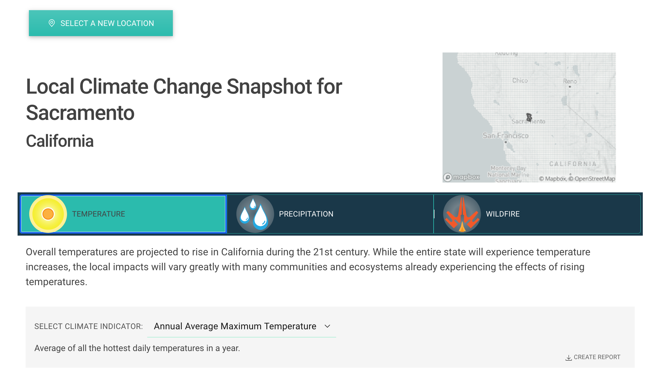
2020 was a year for California’s climate record books. California and the rest of the West Coast was devastated by wildfires, extreme heat, and other historically unusual weather events. Climate scientists have established that climate change contributed to many of these disasters and will worsen such environmental catastrophes in the future, making climate change adaptation all the more urgent.
In recognition of this, the Cal-Adapt team has created a new tool to support climate change adaptation practitioners in addressing the threats posed by rising temperatures, changing precipitation patterns, and climate change-influenced wildfire patterns. So without further ado, we are excited to introduce the Local Climate Change Snapshot Tool (LCCS Tool)!
Multiple Impacts in One Dashboard
The LCCS Tool was developed to serve two purposes:
- Provide a simple, beginner-friendly interface for accessing basic climate change projections
- Support users in accessing climate change projections by location, rather than by climate variable of of interest
The LCCS Tool workflow and interface is particularly applicable for adaptation practitioners who are in charge of adaptation planning for a place, rather than for a specific anticipated impact. We also think that people interested in climate projections for a place they love will find the tool to be valuable!
Select a Location
The first step in using the LCCS Tool is to select a location. There are a few options for location selection:
- Select an address. The LCCS Tool will return climate change data for a grid cell containing the address. Each grid-cell represents climate conditions within a square area of 6 km by 6 km (3.7 mi by 3.7 mi).
- Select a polygon representing a spatial unit - a county, a city, a census tract, or a HUC10 watershed. The LCCS Tool will return climate change data averaged over all the grid cells that intersect the polygon.
To find a location, select one of the Address, County, City, Census Tract or Watershed options.
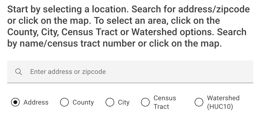
Then, you have two options:
- Type an address; name of county, city, watershed; or census tract number) in the search bar on the left. A list of results closely matching your input will appear as a dropdown list. Select the closest option from the list. The map will then zoom to the location for you to visually confirm your selection.
- Click on the map at your location of interest. The address or name will appear in the search box for you to confirm your selection.
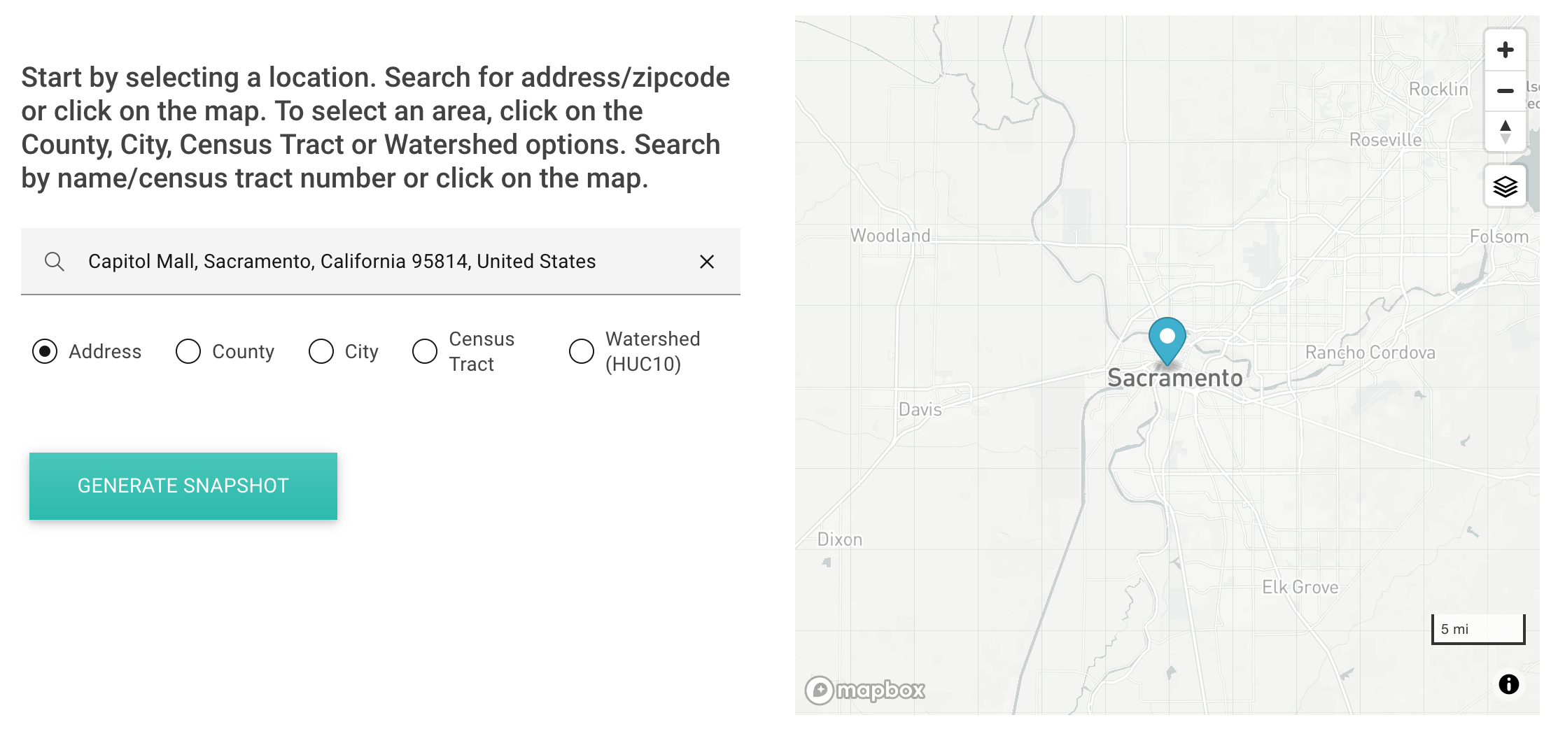
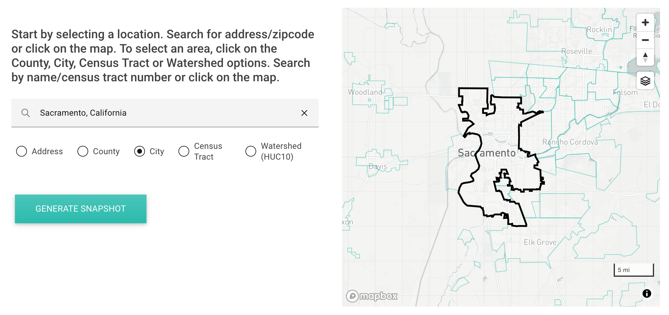
Once you’ve picked your location, click on the “Generate Snapshot” button to move to the next page.
View Climate Change Projections
On the snapshot page, you can explore climate change projections for three variables: temperature, precipitation, and wildfire.

Specific indicators are available for each variable:
- Temperature:
- Annual average maximum temperature
- Extreme heat days
- Annual average minimum temperature
- Warm nights
- Precipitation
- Maximum one-day precipitation
- Maximum length of dry spell
- Annual precipitation
- Wildfire
- Annual average area burned
Additional indicators will be added as they are developed and become available.
For each variable and indicator, data is displayed in a graph and a table. Data is available for two emissions scenarios: representative concentration pathway (RCP) 4.5 (a medium emissions scenario) and RCP 8.5 (a high emissions scenario).
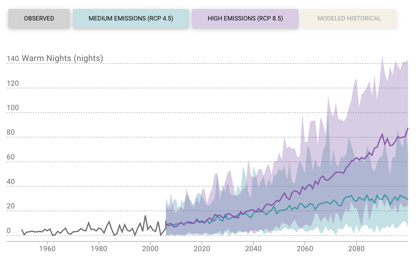
As you’ll note in the image above, you can take a walkthrough tour of the visualization and learn about the data with the links on the left.
In the table, you’ll see that three 30-year planning periods are presented: 1961 to 1990 (the historical period), 2035 to 2064 (the mid-century period), and 2070 to 2099 (the end-of-century period). Projections are presented this way because it’s best to aggregate climate data over periods over a few decades, rather than use projections for a single future year, since climate is about long-term patterns and any given year may not match longer-term trends. For more information on best practices, check out Cal-Adapt Webinar on using climate change data.
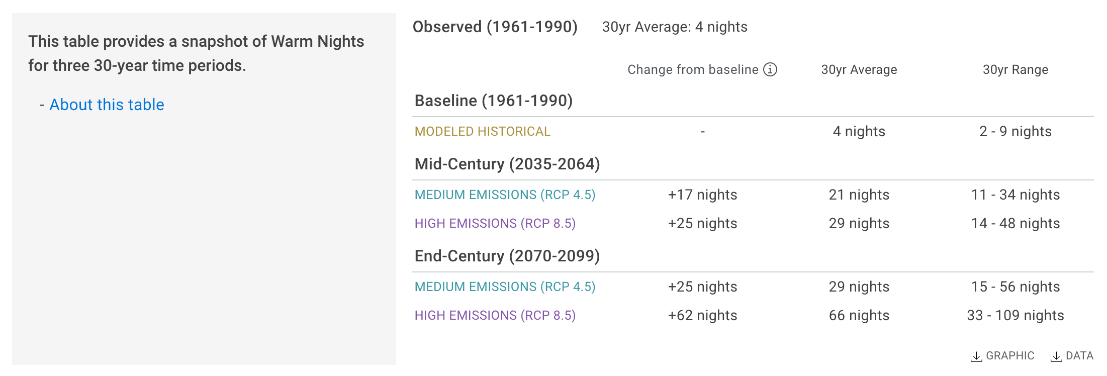
If you’re curious to know how entries in the table were computed, you can take a tour of the table with the “About this table” button on the left.
And lastly, at the bottom of the tool, there are links for other tools and additional resources. Other Cal-Adapt tools let you dig more deeply into a climate change variable of interest. Typically, other tools allow you to customize your analysis by selecting climate models, time periods, extreme event thresholds, or other specific parameter values like temporal aggregation.
If you’d like to know more about how adaptation practitioners are using climate change data and planning for the future, we encourage you to check out the California Adaptation Clearinghouse that is highlighted at the bottom of the Local Climate Change Snapshot tool. The Clearinghouse hosts hundreds of documents ranging from adaptation planning case studies to state-endorsed manuals to datasets and scientific studies. The Clearinghouse is easily searchable, and results can be filtered by sector, planning phase, climate impact addressed, geography, and document type. To make your life easier, if you navigate to the Clearinghouse from the Local Climate Change Snapshot tool, you will be directed to Clearinghouse resources that pertain to the location and climate change variable you selected.
If you want a video walkthrough of the Local Climate Change Snapshot tool, you can watch one here.
Explore
We hope this tool makes it easier to understand how climate change may impact California’s temperatures and precipitation, compared to the state’s recent climate history. If you want to learn more about how to use climate projections, check out our guidance page. And if you have any questions, don’t hesitate to reach out to the Cal-Adapt support team at support@cal-adapt.org.